Routes
Best Multi-Day Hiking Routes in the Canadian Rockies

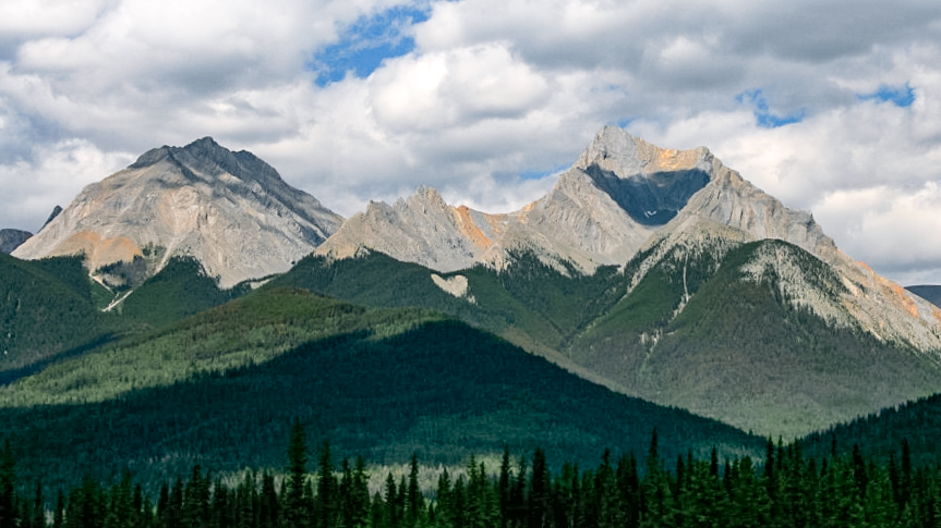
The Canadian Rockies contain some of the most frequently referenced long-distance trails in North America, and the concentration of protected land across four contiguous national parks — Banff, Jasper, Yoho, and Kootenay — means most multi-day routes stay within a managed permit system. What follows is a factual overview of seven well-documented routes, covering their approximate distances, required permit type, and practical access considerations. This is reference material, not a definitive guide; always verify current permit availability and trail conditions with Parks Canada before departure.
1. The Rockwall Trail – Kootenay National Park
Distance: ~55 km point-to-point (full traverse) or ~47 km loop from Paint Pots trailhead.
Typical duration: 4–5 days.
Permit type: Reservation-required Parks Canada backcountry permit.
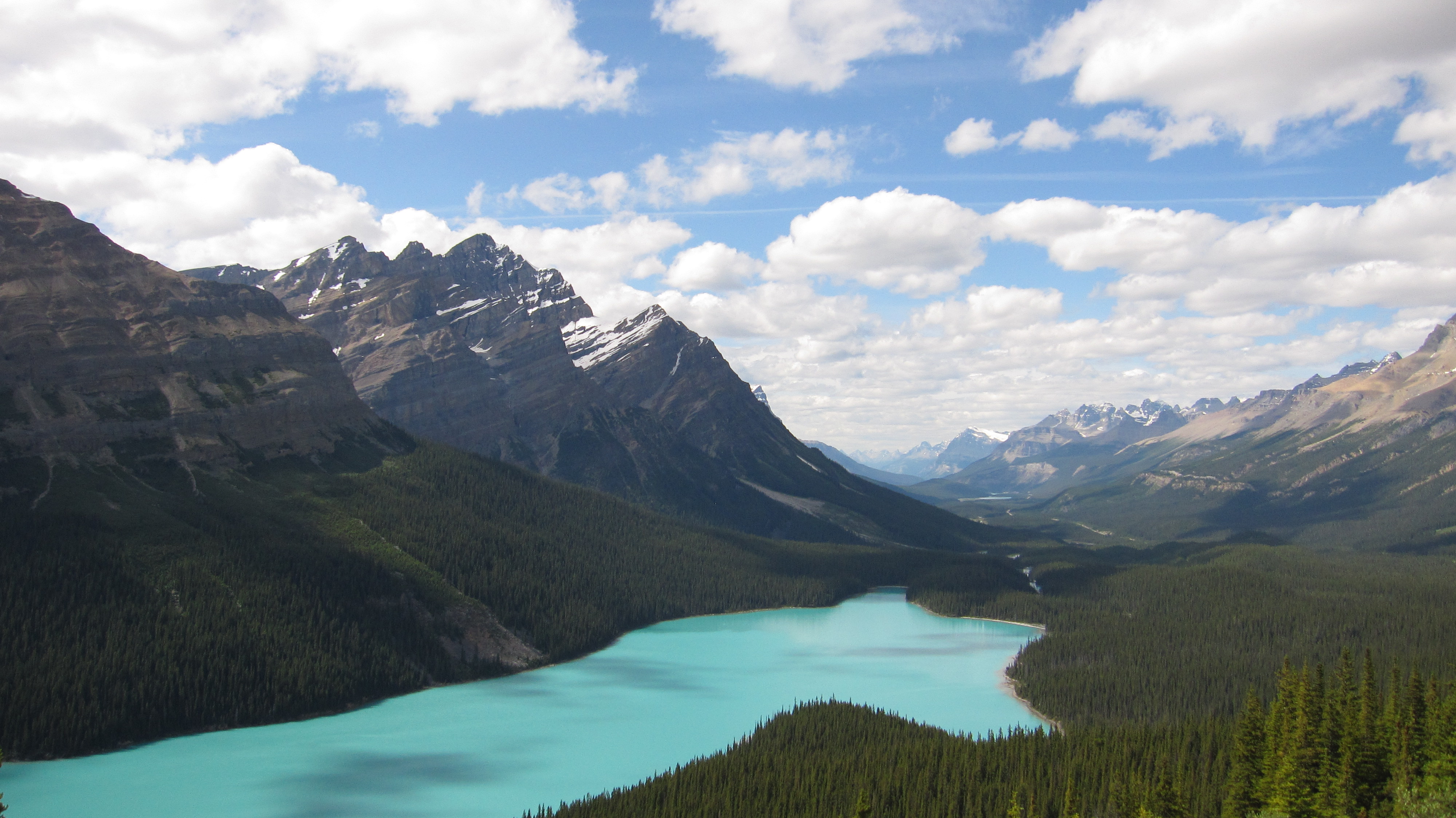
The Rockwall follows the base of a 30-km limestone escarpment through Kootenay National Park, passing through Helmet Falls, Tumbling Creek, and Floe Lake campgrounds. Floe Lake — at 1,980 m, with a direct view of the Rockwall face — is the most requested campsite on the route and fills within the first days of the January reservation window for peak-season dates.
The trail is accessible from the Paint Pots trailhead on Highway 93 South (Banff-Windermere Highway) and can also be accessed from the Marble Canyon trailhead for the northern end. The Rockwall is a designated National Historic Site corridor. Trail conditions at Tumbling Pass — the high-elevation crossing at approximately 2,320 m — typically prevent safe travel before late June.
2. Skyline Trail – Jasper National Park
Distance: ~44 km point-to-point.
Typical duration: 2–3 days.
Permit type: Reservation-required Parks Canada backcountry permit.
The Skyline runs from Maligne Lake to Signal Mountain trailhead near the town of Jasper. A significant portion of the trail — the section known as The Notch, at roughly 2,510 m — remains above treeline, making it one of the most exposed routes in the Canadian Rockies. Weather can deteriorate quickly in this exposed zone. The Curator campground near the midpoint is the most common overnight stop on a two-day itinerary.
Parks Canada introduced a formal quota system for the Skyline in 2019. The trail is managed with departure-date quotas rather than site-by-site reservations at some campgrounds — confirm the current system at the Jasper Information Centre before booking.
3. Citadel Pass Route – Banff / Mount Assiniboine Provincial Park
Distance: ~55 km point-to-point from Sunshine Village to Bryant Creek trailhead.
Typical duration: 4–6 days.
Permit type: Mixed — Parks Canada permit for Banff section; BC Parks permit for Mount Assiniboine Provincial Park section.
This is one of the routes where jurisdiction-crossing creates a two-permit requirement. The trail enters Mount Assiniboine Provincial Park — managed by BC Parks — after descending from Citadel Pass. A Parks Canada backcountry permit covers only the Banff National Park portion of the route; a separate BC Parks permit is required for nights in the provincial park, purchased through the BC Parks reservation system.
The Assiniboine area (the "Matterhorn of the Rockies") is accessible without helicopters only via this corridor or via the longer Spray Lakes route. The area is extremely popular and BC Parks quota sites at Lake Magog fill early.
4. Berg Lake Trail – Mount Robson Provincial Park
Distance: ~22 km one way (Berg Lake) from trailhead.
Typical duration: 2–3 days in, 2–3 days out.
Permit type: BC Parks reservation (Mount Robson Provincial Park, not Parks Canada).
Mount Robson Provincial Park is managed by BC Parks, not Parks Canada. The Berg Lake Trail — ending at Berg Lake at the base of Mount Robson, the highest peak in the Canadian Rockies at 3,954 m — is one of the most recognized backcountry routes in British Columbia. The trail passes Kinney Lake and enters the Valley of a Thousand Falls before reaching the terminal moraines above Berg Lake. Iceberg Lake is a short detour from the main campground area.
Reservations are managed through bcparks.ca with the same January opening that many BC Parks routes use. Sites fill very quickly. A quota system is in place for peak season; permit-free travel is not available during July and August.
5. Tonquin Valley – Jasper National Park
Distance: ~19 km to Amethyst Lakes from Astoria River trailhead, or ~26 km from Maccarib Pass trailhead.
Typical duration: 2–5 days depending on loop or point-to-point configuration.
Permit type: Reservation-required Parks Canada backcountry permit.
Tonquin Valley sits at the base of the Ramparts — a 10-km wall of quartzite peaks rising roughly 600 m above Amethyst Lakes. The valley receives heavy rain relative to drier parts of Jasper and is more prone to afternoon thunderstorms. The two access routes — Astoria River (longer valley approach) and Maccarib Pass (shorter, more exposed) — allow for a loop itinerary. A private backcountry lodge also operates in the valley; lodge guests use a separate quota allocation.
6. Bow Valley Highline and Lake Louise Area Circuits – Banff National Park
Distance: Variable; common 3-day loops cover 35–50 km.
Permit type: Reservation-required Parks Canada backcountry permit.
The area around Lake Louise and the Bow Valley Highline offers several linked multi-day circuits using campgrounds at Halfway, Egypt Lake, and Gibbon Pass. These routes are among the most permit-competitive in Banff, given their proximity to the Trans-Canada Highway and the high volume of international visitors using Lake Louise as a base. Egypt Lake Shelter is a particularly high-demand site — it's one of the few sites with basic shelter infrastructure and tends to be booked by groups early in the season.
7. Garibaldi Lake Backcountry – Garibaldi Provincial Park, BC
Distance: ~9 km to Garibaldi Lake from trailhead; longer if extending to Panorama Ridge or Black Tusk.
Permit type: BC Parks reservation.
Garibaldi Provincial Park sits roughly 60 km north of Vancouver, making it the most accessible significant backcountry area in British Columbia. The Garibaldi Lake campground is quota-managed; sites fill within hours of the reservation window opening each January. The campground sits at 1,470 m above sea level at the edge of the lake, with direct views across to The Table and Sentinel Glacier. Day hikes from camp to Panorama Ridge (elevation ~2,133 m) and Black Tusk (ascent to ~2,319 m, scramble terrain on upper section) are both feasible from the campground.

General Notes on Permit Timing
For all routes managed by Parks Canada, the reservation window for the following summer typically opens in the second week of January. BC Parks follows a similar schedule for most quota-managed campgrounds. Provincial parks in Alberta, Ontario, and elsewhere have their own schedules — check each park's individual booking page for the precise opening date.
September dates across all of these routes are typically easier to book than July or August, and the trails are considerably less crowded. Bear activity increases in September as animals prepare for winter, which makes bear canister requirements and food storage practices particularly important late in the season.

